Here's a screen shot of my chart software when zoomed to 0.2m viewing a region around the SW of the river Dart (note the pink highlighted zone):
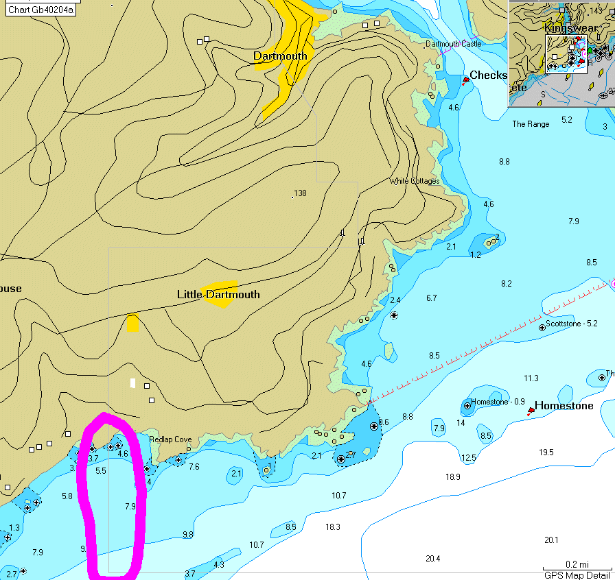
Here's a zoomed in view of what's in the pink highlighted bit from the above image:
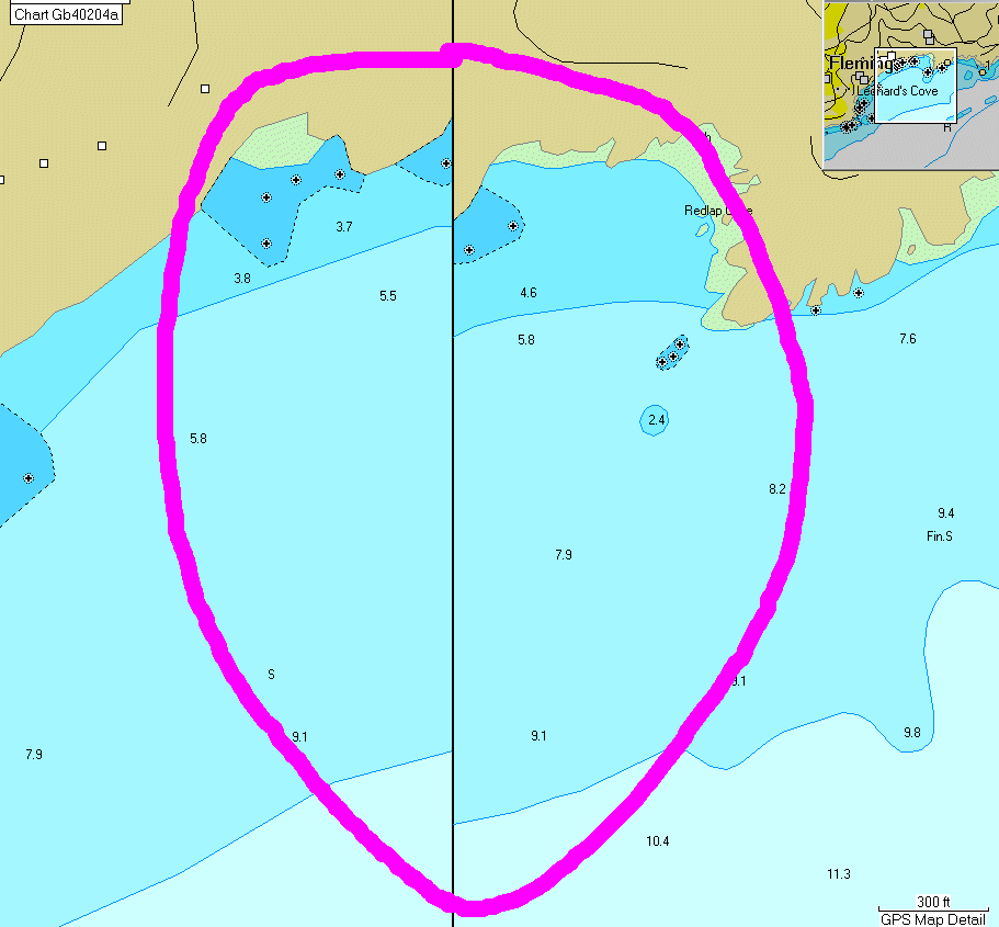
Anyone tell me why there's the error where the chart boundary is? It's suggesting to me that one side of the boundary is shifted and hence not accurate... got to be at least an error in one or other of nearly 100m!!
Location is: N50 19.487 W3 35.222
Is this normal?
PS. This is from Garmin Mapsource running the latest (9.5) BlueChart software for the channel.
--
Update. I called Garmin tech support and got through to the marine charts section. The guy at the end of the phone admitted to me that this is definitely not meant to be like this, and that it's definitely a mistake in the charts. He said they'd call me back, but that was over a week ago now, so I guess they're not going to