Garmin Bluechart Charts - Dangerous Error!

Discuss anything to do with safety, technical aspects of yachts and engineering, and anything else to do with yachts and yachting in here.

Moderator: Jeff

Post Reply
bobholiday
RNLI Supporter
RNLI Supporter
Posts: 148
Joined: Thu Nov 29, 2007 9:11 am

Garmin Bluechart Charts - Dangerous Error!

Post by bobholiday »

Hi, a little help please... and just to let you know of something potentially dangerous if navigating in limited visibility by electronic chart alone.

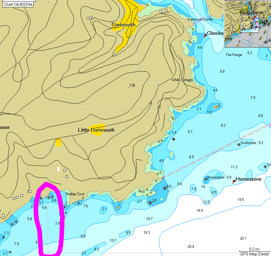
Here's a screen shot of my chart software when zoomed to 0.2m viewing a region around the SW of the river Dart (note the pink highlighted zone):
Image

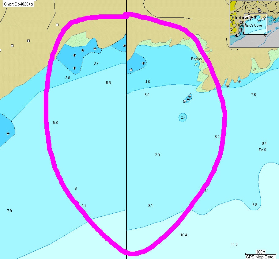
Here's a zoomed in view of what's in the pink highlighted bit from the above image:
Image

Anyone tell me why there's the error where the chart boundary is? It's suggesting to me that one side of the boundary is shifted and hence not accurate... got to be at least an error in one or other of nearly 100m!!

Location is: N50 19.487 W3 35.222

Is this normal?

PS. This is from Garmin Mapsource running the latest (9.5) BlueChart software for the channel.

--

Update. I called Garmin tech support and got through to the marine charts section. The guy at the end of the phone admitted to me that this is definitely not meant to be like this, and that it's definitely a mistake in the charts. He said they'd call me back, but that was over a week ago now, so I guess they're not going to :roll:
DaveA
RNLI Supporter
RNLI Supporter
Posts: 222
Joined: Wed Jul 23, 2008 6:23 pm
Location: Lincolnshire
Contact:

Post by DaveA »

The fact that the error is there in the first place doesn't bode well for the chances of them ever getting back to you. Thankfully I don't think I'll be sailing that area, bit far for me :lol:
Come on over to the best place to buy and sell your boaty bits www.sailroom.co.uk
Post Reply